VIEWS OF CANADA
|
|
VIEWS OF CANADA
Photos of All Regions of Canada |
|
|
 |
 |
 |
 |
The GoalCANADA, our home and native land! What a vast and beautiful land it is! Few people ever see its many faces and moods. I hope these images will kindle a sense of wonder while bringing substance to our patriotism.
How they were chosenForest, prairie, tundra and sea coast: so many landscapes! How to make sense of them all.
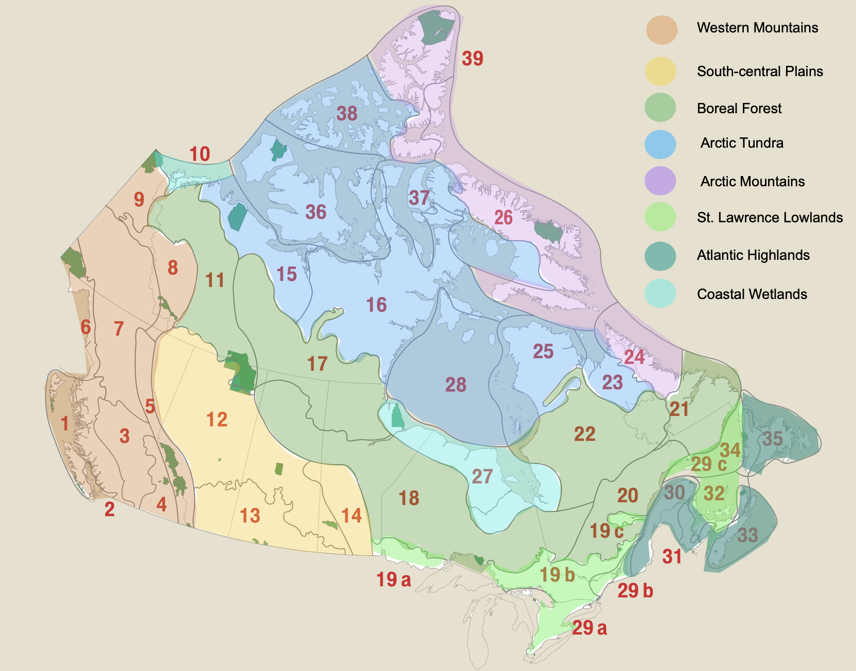
Major features like the Rocky Mountains and Canadian Shield, with the Prairies in between, and the Tundra to the north, give a very general impression of the scope. Vegetation cover, influenced by the latitude and amount of precipitation, bring another level of detail. Parks Canada has fine tuned these to produce a list of 39 distinct Natural Regions. This agency intends to designate at least one national park in each of these areas.
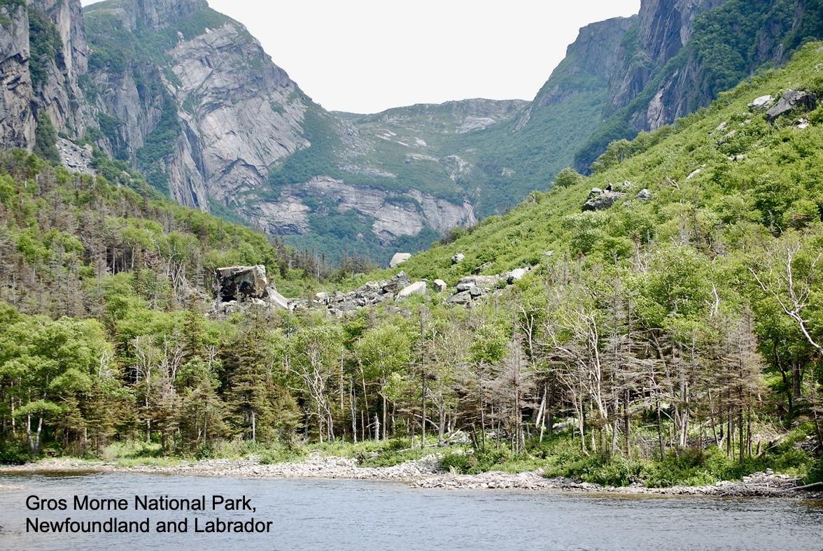
This website includes a two-page description of each region from Parks Canada's System Plan. This document was compiled in 1997, so the sections on existing and planned parks is quite dated, but the land descriptions are still accurate. I have supplemented this text with about ten photographs showing typical scenery. Additional information has been added, indicating the main communities present, important parks and land uses. I hope you enjoy the additional information included in the links I have added, indicated by underlining.
The major groups of indigenous people are indicated for each Natural Region. Their names have been taken from Royal Canadian Geographic Society's Canadian Geographic Indigenous Peoples Atlas of Canada (2018). This volume includes contributions from numerous aboriginal people, and covers many important aspects of reconciliation.
Get Involved!I hope you will take part by submitting photos or comments to info@transitionmedicinehat.ca.
Last modified February 20, 2026
|